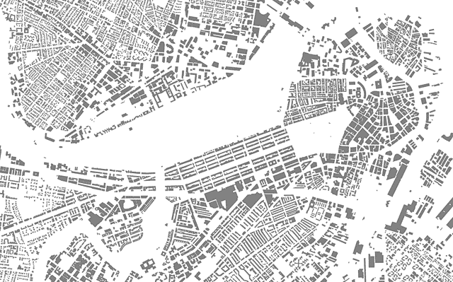
We mapmakers earn our keep by somehow adding value to raw geographic data; that is, the craft requires more than just plotting the location of objects on the Earth’s surface. But sometimes it’s hard to compete with the simple elegance of a stripped-down display of geographic shapes. Some of my favorite images of that ilk are maps of city building footprints.
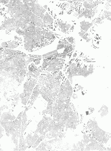
Or how about a much larger extent that includes most of the city?
Despite the objections of some detractors (you know who you are, and I know where you live), there is some worth to this kind of map. Sure, there’s really nothing to it—the map was simply cranked out from MassGIS data. If nothing else, though, it’s kind of pretty, revealing the sometimes aesthetically pleasing patterns of the built environment.
Besides being inconsequential eye candy, though, the map is somewhat useful for interpreting urban geography. Some manmade patterns are much clearer in this map than in an aerial photograph you’d find on Google Maps or elsewhere, which shows all this and more. Assuming some base level of local knowledge (say, where the ocean is), it’s possible to identify various spaces: built-up (gray) versus open (blank) areas, downtown (large, dense footprints) versus residential (smaller, separated footprints) areas, steetcar suburbs (long main drags with density dropping a block or two away) versus more interior urban areas (consistent density and often smaller, straighter blocks), and so on.
But mostly it’s a pretty picture. I’m not alone in thinking so, right?


prettyyyyyyyy
I think that this is one of the most brilliant types of maps. Because it doesn’t give away all the answers, it engages the reader and encourages her to speculate, question, etc.
Reminds me of Ben Fry’s streets map:
http://benfry.com/allstreets/
Glad we’re on the same page, Ryan. Maps like this are not “useful” in the traditional sense, but they are the type that prompt wonder and ideally interaction with the real world to answer the questions inspired by the map.
Also, All Streets is one of my favorite maps ever. Thanks for the reminder!
It would be great if you offered a larger version of the top map – it would make a sweet wallpaper!
Good idea! Tell you what, here’s a rather large image of the entire area I originally exported (about 4.5 MB and 7,000 pixels across) for anyone who wants it. Perhaps a section can be used for computer wallpaper, or it should be large enough to paper a small part of an actual wall.
Thanks Andy! That is perfect.
Pingback: Density | Bostonography