Bostonography provides us with the perfect forum for sharing bizarre, hybrid posts that randomly incorporate some of our favorite things. There is no doubt that soon enough, I will write something up on gummi candy maps of Roxbury… even if I have to make (and eat) them myself. But that’s for later; today’s contrived combination of cartographic interests will be map pins and… well, Boston, of course.
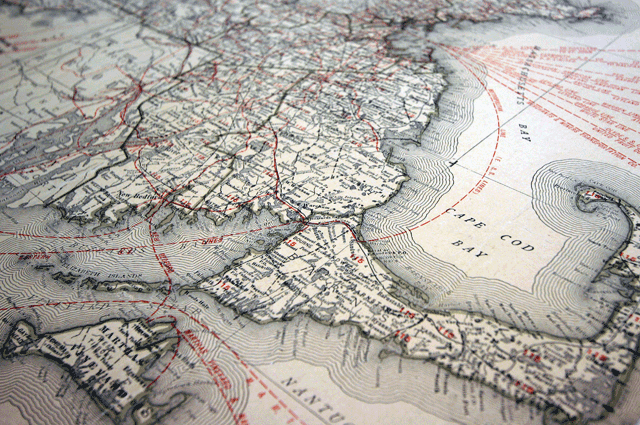
I opened this post with a cartographic image of Massachusetts. This map was designed specifically for the Rand McNally Map-Tack System some time in the first half of the 20th century. Yes, that’s right—Rand McNally sold something called a “Map-Tack System.” What made it a system, you ask? Well, Rand was simplifying a painstaking interactive mapping process that people had been struggling with for decades.
Pin maps have been in use for centuries. Heck, even Napoleon was into pinning maps. But until Rand’s Map-Tack System came along, folks who wanted one were forced to fashion their own map pins, coat their own maps, and build the mount themselves. A diagram in a short pamphlet entitled Charts and Maps as Used by Health Professionals (1918) suggests using cork and cellular board in a map mount’s construction. In Graphic Methods for Presenting Facts (1919), Willard Brinton, who has been discussed in two Making Maps posts, offered up a somewhat lengthy description of a do-it-yourself approach to building a pin map mount:
A very cheap yet satisfactory mounting for a wall map to be used with glass head map pins is made with three or more layers of corrugated straw board. The straw board used should be about 3/16-inch thick with a facing on either side of the corrugated portion. Three thicknesses of straw board are sufficient to give strength for any map up to one yard long. The two outside layers of straw board should be so arranged that the corrugations will run with the length of the map thus giving the greater strength in that direction. The middle layer should have the ribs running crosswise of the map so that the map mounting will be safeguarded from bending in either of the two different directions. Where very large wall maps are desired six or more layers of straw board may be used to give sufficient strength. If single sheets of straw board cannot be found as large as the map itself the map mounting can easily be built up of small sheets of straw board provided the joints in the straw board are so placed that they will not be over each other to weaken the finished structure.
Given these exhaustive specifications, it’s no wonder that Rand’s Map-Tack System was so popular (and it was – anyone notice the maps used by FBI agent Van Alden in the HBO series Boardwalk Empire). Rand provided the mount—which fit perfectly in the Map-Tack System cabinet, whose drawers were deep enough to accommodate pins. It also provided the maps (printed on “supercalendered paper with light inks”), and a whole host of pins, flags, spot signals, cords, beads, rings and other accessories. Gone were the days of fussing about to make your own straw board mount, coated map and custom pins.
Although I don’t have an image of it (I’m still looking), it’s more than likely that at some point, there was a map of Boston that was adorned with all of the aforementioned Rand Map-Tack System accoutrements. Intriguing-sounding pin maps from the first half of the 20th century are cataloged extensively on Google Books. Buried in old pamphlets, magazines and books are references to pin maps of the Boston area showing water and sewage works incidents; episodes of tuberculosis; illnesses in school children; crime; political district lines and distribution of car dealerships—they’re just not pictured (boo!).
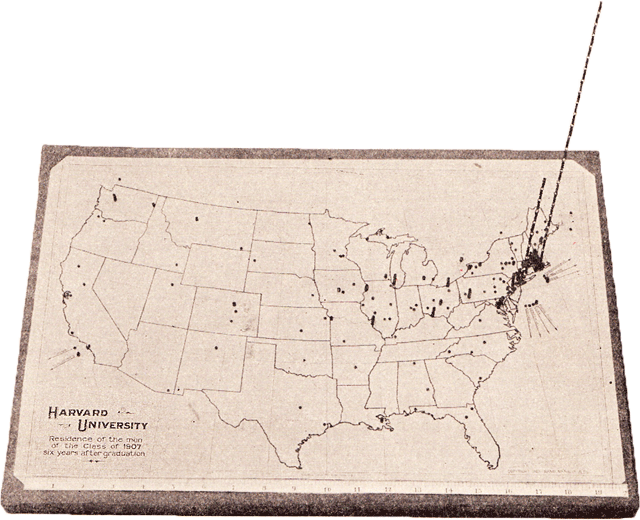
That is not to say what we don’t have a couple of examples. Here, for instance, is one of my favorite pin maps to date. This map from Brinton’s Graphic Methods for Presenting Facts shows the distribution of Harvard University graduates from the class of 1907. Note the vertical extensions of the pins on the East Coast. Nowadays, with digital pushpins, overlapping data points remain a logistical hurdle for cartographers. Although some methods exist for coping with this problem (aggregating data points at different scales, or fanning out the pins so that all are visible when clicked), none is perfect. The same might be said for this method; it’s clear that many Harvard graduates from the class of 1907 have remained in the Boston area, but quickly attaining any kind of hard data from this map would be difficult, if not impossible. Still, stacking beads on hardened piano wire is probably better than cramming all of the pins next to each other, no?
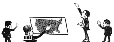
One of the biggest players in the “Map Pin Industry” during the first half of the 20th century was located in our sister city to the south, Providence, Rhode Island. Edexco sold “Devices for Graphic Business Records” and their advertisements featured long-armed businessmen going about their graphing with gusto. After living most of my life in the Boston area, it’s hard to believe that, at some point or another, I wouldn’t have noticed that men in Providence have fantastically long arms.
Edexco didn’t just sell the goods for making pin maps. They also published and sold vaguely scientific pamphlets on how pin maps should be used. These pamphlets featured guidelines on what type of pins to use, how to insert pins into a map, how to set up a mount, selecting appropriate color schemes, &c. They also offered a number of case studies featuring successful pin maps. Here is one such case study: A map showing where Boston’s milk was obtained in 1915.
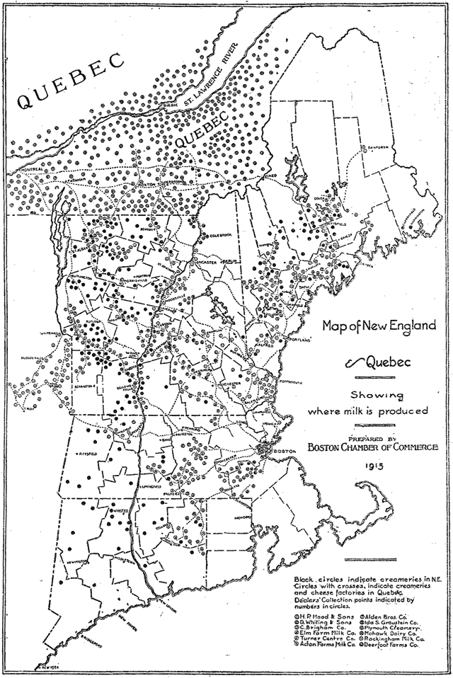 When I look at this map, I imagine an extremely long-armed man spending endless hours meticulously placing pins to indicate the locations of creameries in New England and Québec. Don’t you?
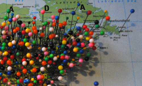
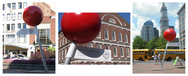
Sadly, that is all I have for old pin maps relevant to Bostonography. I’m sure there are more out there, though, so I’ll be sure to post them as I find them. In the meantime, I’ll leave you with an image featuring Boston’s “Visit the Pin” program from the summer of 2008. At the time, Google Maps had been around for a few years and the pin map (by then largely digital) had re-entered our collective graphic vocabulary. Boston decided to capitalize on this by placing larger-than-life pins throughout the city to promote various points of interest. Not a bad idea… although I can’t speak to how well the scheme worked. I was completely unaware of the program until years later.
Commenting on one’s own blog post seems somewhat ridiculous, but I had to add one last thing. It looks like there was another big “map pin industry” company located a little closer to Boston. Graffco. Check it out.
just read ur artical on rand mcnally’s map tack system. i have a desk from early 1900’s with 10 maps built in the draws ma is one of the states it is quarter sawn oak about 24″ wide 33or 34″ deep and about 4 ft tall its pretty cool i acquired from a gentalmen from the boston area he said it was used by the railroad during world war two have pics if interested in buying