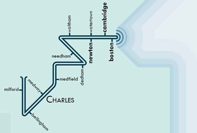
I have a special place reserved in my heart for the Charles River. I love it. Sure, sure, most people do, right? It’s a significant river. Heck, Paul Revere crossed that river while embarking on his famous midnight ride. And after that random Sox fan jumped into the Charles during the 2004 World Series victory parade… gosh, how could you not love that dirty water?
So, when I heard that my colleague, Daniel Huffman, had plans to make a series of transit-style river maps, my interested was obviously piqued. “So, hey, Daniel. Any plans to make one of your newfangled river maps of New England?” I asked. “Should I?” he asked. Um, yes, he should. And he did. And it is pretty great, so check it out if you have a moment.
Daniel’s Major Stream Systems of Southwest New England map features the Charles, Housatonic, Shepaug, Naugatuck, Hoosic, Quinnipiac, Connecticut, Farmington, Scantic, Westfield, Deerfield, West, Ashuelot, Millers, Chicopee & Ware, Quaboag & Five Mile, French, Quinebaug, Thames/Shetucket/Willimantic/Middle, Blackstone & Seekonk, Merrimack, Concord, Sudbury, Assabet, Nashua, Beaver, and Souhegan rivers.
Oddly, what river almost didn’t make the cut on this map? The Charles. “Yikes!“, you exclaim? Well, so did I when Daniel first asked if he should include it. It turns out that based purely on length, the Charles doesn’t stack up that well against other systems in New England. Still, it didn’t take much convincing to get him to admit that the map just wouldn’t be right without it. I think it was my story about watching my dad’s annual canoe race that was the clincher.
You must love the Charles. Dirty or not.


I think you also had a hand in ensuring that the Blackstone made it on, as well.
Pingback: Tweets that mention The Mighty Charles | Bostonography -- Topsy.com