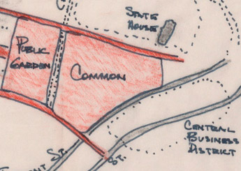
 “Boston, the city directly at hand, is unique in character among American cities, being both vivid in form and full of locational difficulties.”
In the 1960 seminal city planning and mental mapping book The Image of the City, MIT’s Kevin Lynch wrote the above remark on Boston. Its physical setting, quirks of layout, and diversity of neighborhoods conspire to make Boston a very “imageable” city, to use Lynch’s word, in people’s minds. Those images of Boston, when put to paper or screen as maps and graphics, can be fascinating in their meaning, or sometimes just plain nice to look at.
Bostonography is, at least, a site for interesting visual representations of life and land in Greater Boston, and at best it exposes and explores the geographical sense of place in the city. It begins with maps but needn’t be confined to them. In addition to linking to existing designs the aim is to inspire the many brilliant and creative people around here to turn their talents toward their city. As a showcase of such efforts large and small, perhaps Bostonography can do its tiny part to help people better know their city, spur further exploration, instill civic pride, and build a sort of graphical visibility that promotes Boston as a cool city to the rest of the world.
Ideas, comments, maps, and hellos are most welcome!
![]()
Also follow us on Twitter at @bostonography.
This site is run by—and includes maps by—two cartography nerds whose paths occasionally cross, sometimes even in Boston. We have in common the Geography graduate program at the University of Wisconsin-Madison, although we didn’t overlap there. We met at geography and cartography conferences all over the place and through our mutual friends, and it was at one of these conferences that we hatched the Bostonography scheme.
Andy Woodruff, Axis Maps
I grew up as a regular visitor to Boston, my mom being a native and a BU alumna, and became an area resident when I moved to Cambridge in 2008. That’s a lifetime short of being a real “local” by the standards around here, but I’m doing my best. I think I can at least imitate the local accent better than most people from my home state of Ohio, and I’m always exploring the city by foot, by train, by bicycle, and by study.
My day job is being a partner in Axis Maps, where we do custom interactive cartography and also sell typographic map posters. This site is, in part, a way to combine my endless desire to make maps with my endless desire to learn about and become a part of this city.
Tim Wallace, PhD (UW-Madison Geography) & Freelance Cartographer.
I don’t currently live in Boston, but it sure is my home. I was born in Boston and grew up frustrated by the Sox and mystified by the gigantic hole in Back Bay that existed during the construction of 500 Boylston. Nowadays, I recently finished a PhD in Wisconsin and am working as a Graphics Editor at The New York Times.
It’s fair to say that I enjoy mapping. It’s dead on to say that I love Boston. So, for me, combining the two is a dream.