Fair warning: some day I am going to post long, questionably logical rants and ramblings about boundaries. I have a thing for—actually, against—boundaries invented by humans and what they do and don’t, and should and shouldn’t mean.
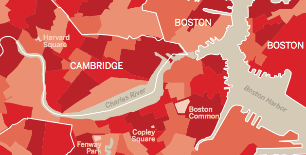
This is not that post, but given my interest I was glad when Ryan Sullivan pointed us to some nice work he recently did for ArchitectureBoston magazine. Titled Redraw, Reboot, his maps (and accompanying text by Elizabeth S. Padjen) examine municipal boundaries in the Boston area and all of Massachusetts, then re-invent those boundaries in a few different ways.
Municipal boundaries are essentially arbitrary, or sometimes based on centuries-old roads and landmarks, and today do not necessarily represent any culturally or physically meaningful entities. The Redraw, Reboot maps present some alternatives bases for municipalities that encourage us to think about how we divide ourselves and how we gather together. The new maps are these:
TownMeetingships Municipalities reorganized into populations of fewer than 6,000 residents to enable traditional town hall meeting governance
HouseTowns Municipalities reorganized by electoral districts in the Massachusetts House of Representatives
EcoTowns Municipalities organized into areas with similar geology, physiography, vegetation, climate, soils, land use, wildlife and hydrology
TownSheds Muncipalities reorganized based on watersheds
And, obviously:
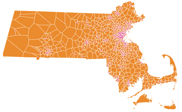
Donutowns Municipalities reorganized based on nearest Dunkin’ Donuts store (boundaries determined by running the voronoi theorem based on store locations)
Grab the maps and article from the ArchitectureBoston site, and see more at Mr. Sullivan’s site. (Check out his other work while you’re there!)
If you hang around cartography circles enough you’ll run into this kind of thought exercise, but usually with regard to states, for example the 38 States or 50 states of equal population. Basing states on watersheds also rings a bell from a NACIS conference in recent years. It’s interesting to see something similar applied to a local level where our everyday lives take place. I’ll save my rants on the topic for another day, but in the meantime, just think about it: what, if anything, does that line on the map really mean?


John Wesley Powell advocated that the western US be divided into states along watershed boundaries. Obviously Congress found that way too difficult to execute – leading to decades of interstate legal fights over water…
I went looking for the Donutowns map, took me a minute to realize you were joking.