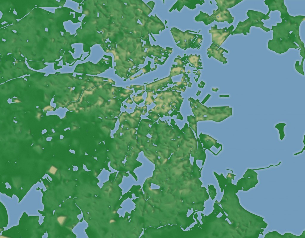
Some neighborhoods of the Boston area are actual islands, or were at one point. Others, however, can feel that way even when connected to each other by land. Water isn’t the only thing that can create a gulf between neighborhoods; sometimes it’s created by features of the urban landscape and the experience of passing through them.
To me, one of those things is an unpopulated area. Even if two pieces of the city are contiguous with no real empty space between them, if there’s a zone between them where nobody lives (perhaps a commercial district or even a nice park), the experience or idea of passing through there increases the distance between the two neighborhoods in my mind. Thus a neighborhood that is physically close becomes a “somewhere else” to me, and I remain on my island.
The above map aims to represent that experience, imagining land and water as defined by population. Any unpopulated areas (according to census data) become water, population density becomes the terrain, and Boston becomes a rugged world of islands and lakes.

The cemeteries between where I live in Jamaica Plain and Mattapan make the two neighborhoods feel light years apart.