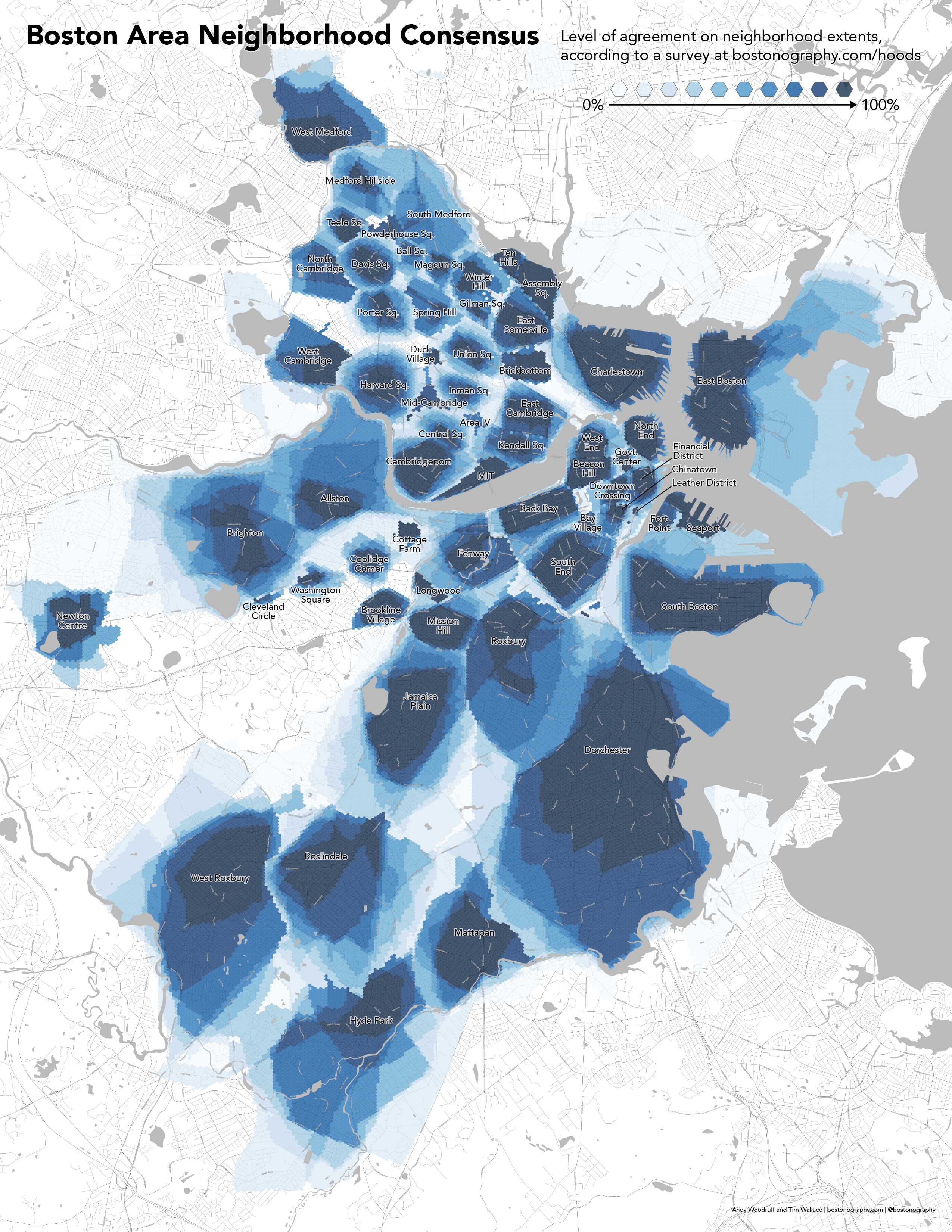
Time for an update on the classic-yet-ongoing neighborhood mapping project! To recap: we’re on version 2 of a web survey for mapping Boston-area neighborhoods, the boundaries of which can be the subject of much disagreement. We’ve asked people to draw neighborhood extents as they see them, in an attempt to collect enough of these crowd-submitted shapes to be able to say something about the overall popular perception of neighborhood geography.
Here’s the fuzzy map of neighborhoods according to a snapshot of some 2,300 submitted polygons in our data, as of March 2017.
This is a fun update over previous editions mainly for two reasons: it includes areas outside the city limits of Boston, and it is not limited to a pre-selected set of neighborhood.
The way this map works is:
1) Lay a somewhat-fine grid over the area. These hexagonal cells are something like 75 meters across.
2) For each cell, find the most commonly named neighborhood intersecting it.
3) Measure consensus on that cell as the number of submissions for that neighborhood intersecting the cell, divided by the total number of submissions for that neighborhood. Thus we can say something like, “75% of people who drew the South End agree that this location is part of the South End.”
4) Ignore any neighborhoods with fewer than 5 submissions. This weeds out all the joke/rude submissions, but also is just an arbitrary minimum for measurable consensus.
The consensus map does a decent job of showing where boundaries are hard and where they’re fuzzy or uncertain. Without that, a simple map categorized by name looks like this, in hasty random color screenshot form:

It’s also worth doing a quick comparison to official boundaries. Here’s one with official lines for Boston and Cambridge overlaid.
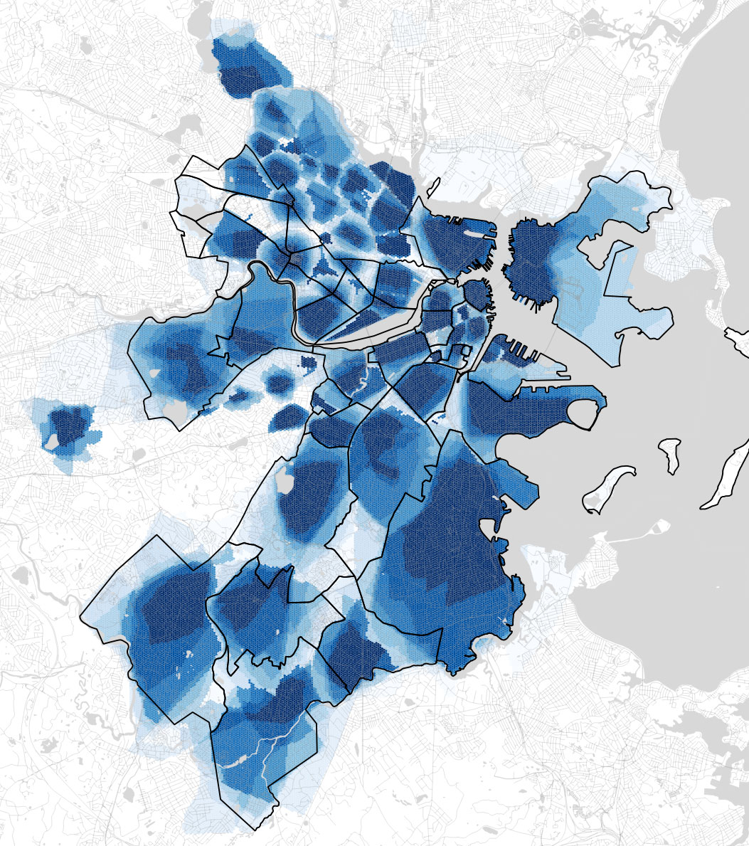
Boston does a pretty good job, with a few exceptions that I notice:
- People prefer to subdivide downtown and the waterfront area into smaller neighborhoods.
- Official Mattapan intrudes on Dorchester a bit—exactly how much is hard to say from our data, but certainly the bit beyond Morton Street looks too far.
- Official Hyde Park eats a slice of Mattapan, even some bits with 100% Mattapan consensus in our data.
- Official Jamaica Plain appears to intrude on Roslindale.
Much of Cambridge, however, is quite different, as people tend to think of the city in terms of squares like Central or Harvard, while the official boundaries put the squares between neighborhoods.
Keep the submissions coming! It would be great to see more neighborhoods pass the threshold and appear on this map, and as always it’s fascinating to see how the shapes evolve and settle. Thanks for everyone’s participation so far!
Pingback: Boston official unofficial neighborhoods, 2017 – GeoNe.ws