By now you’re aware that today marks 100 years since Boston’s Great Molasses Flood (or Molasses Disaster, or whatever you may call it). On January 15, 1919 a huge tank of molasses on the North End waterfront collapsed, releasing a viscous deluge that killed 21 people, injured a further 150, and damaged and destroyed structures. It’s not a story we need to tell here; it’s been thoroughly told by others over the years. Start with Wikipedia and end with Stephen Puleo’s book Dark Tide, which tells the whole tale in vivid, personal detail. (See him speak at the Boston Public Library tonight!)
But we can point you to maps, and tell tales of geography!
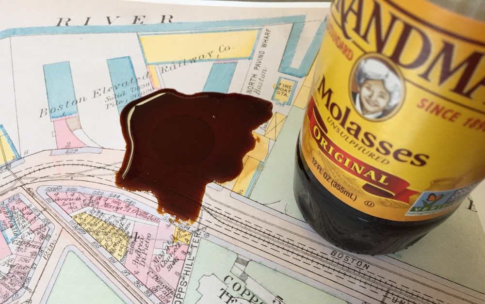
A contemporary map of the area is from the Atlas of the City of Boston 1917 edition. The blue circle next to Commercial Street is the molasses tank that had been constructed in late 1915.

For better context, here’s the same map with a puddle of molasses on it.
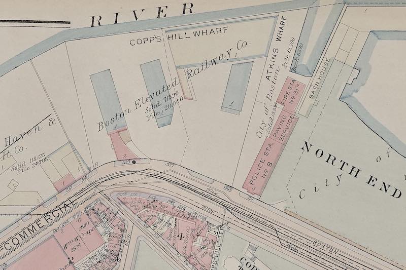
By the 1922 edition of the map, the tank of course was gone, along with some of the neighboring buildings.
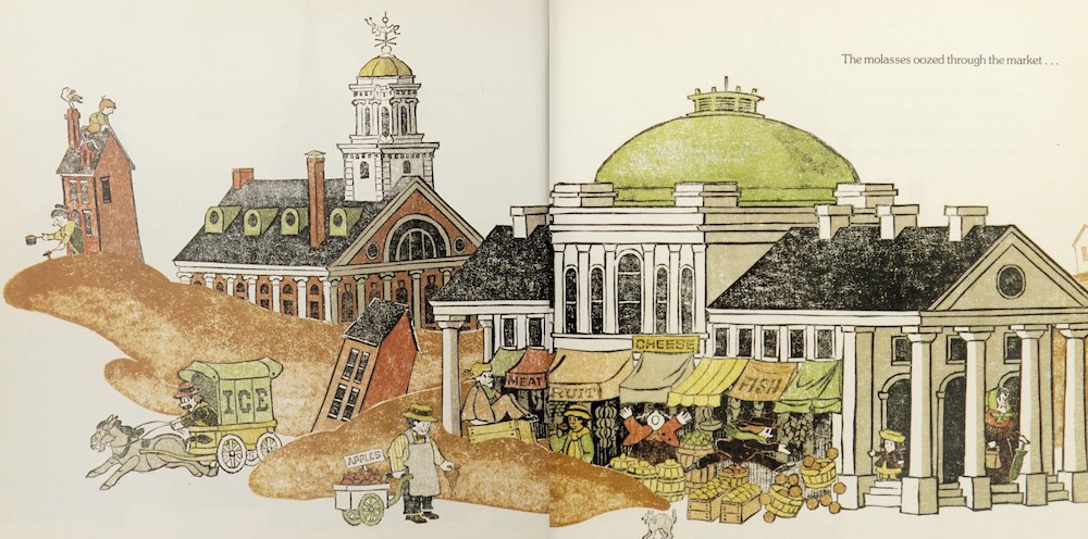
At one time I had imagined a tsunami of molasses racing through the narrow North End streets, sweeping away crowds and houses in its path. As destructive as the disaster was, that picture really isn’t correct, nor are the events as imagined fancifully in the 1992 illustrated book Molasses Flood by Blair Lent (which of course Tim has read), inundating Faneuil Hall, the State House, and more.
The affected area was mostly the industrial-ish waterfront and Commercial Street itself (a big street by North End standards), and about one block of residential buildings facing that street. This Boston Globe Magazine article includes a nice little animation of the area covered. And geophysicist Steven N. Ward has gone the extra mile of simulating the physics of it all, with animated 3D renderings.
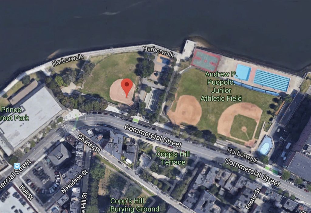
Today the immediate area retains hardly a trace of its 1919 self, at least on the harbor side of Commercial Street. The waterfront no longer bustles with industry, and the street no longer hosts an elevated railway (famously damaged by the force of molasses) nor freight tracks. The site of the tank itself is a baseball diamond in a peaceful park. The aforementioned Globe article has an interactive then-now comparison, or you can take a look at Google Maps.
To recall the molasses flood is to recall a different Boston, geographically. It’s not just which buildings are still here and which aren’t. It’s entire swaths of the city having a wholly different character. You wouldn’t see a ship unloading cargo in this part of the North End, and you’d hardly think of Cambridge—where molasses from the tank was destined—for industrial-scale distillation of alcohol. De-industrialization of some Boston-area neighborhoods is recent enough to be in many people’s memories, but some day it’ll all be like looking back at the days of the molasses flood, imagining a totally different city from what anyone alive knows.
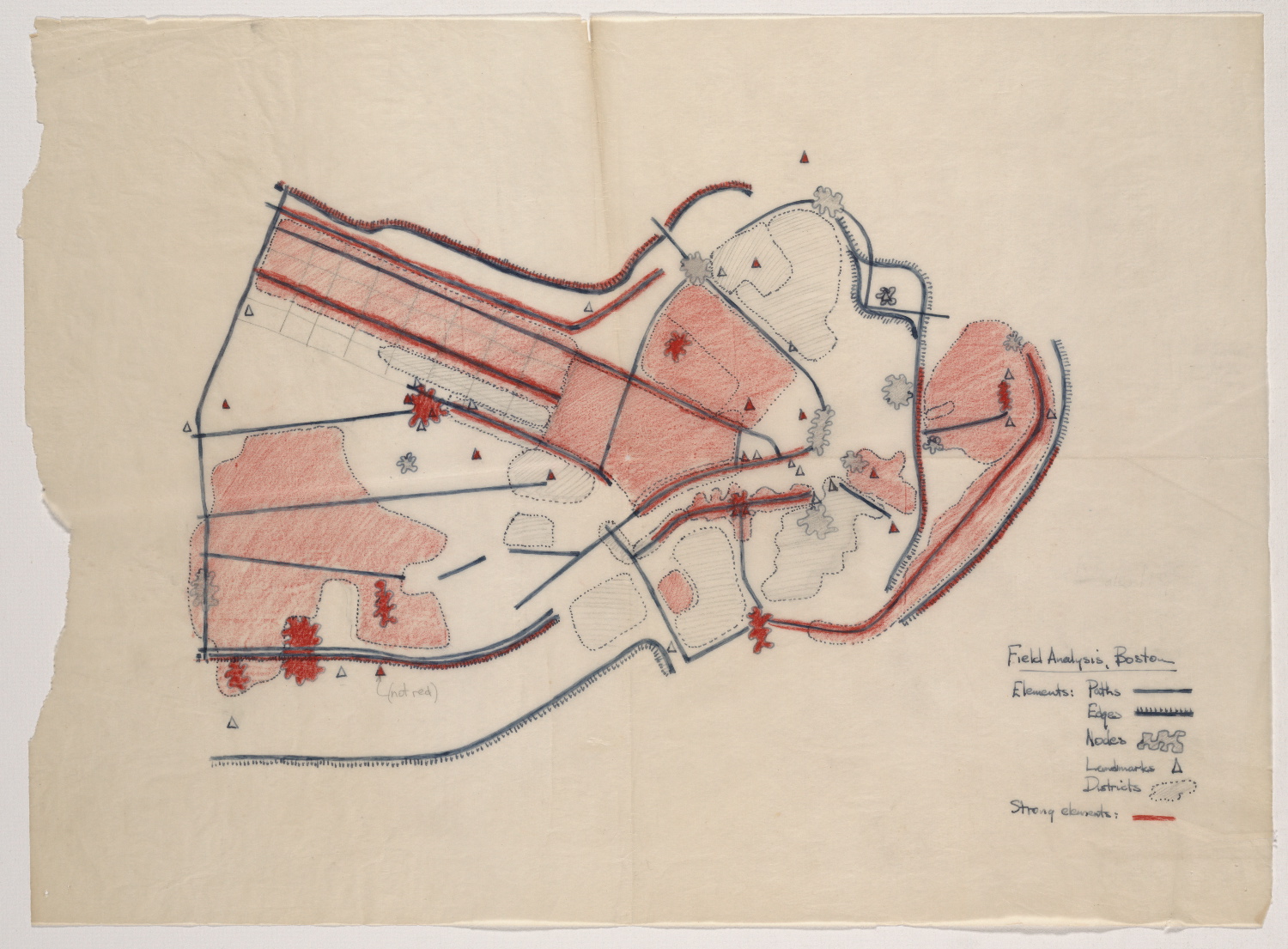
The molasses episode also tells of a Boston that had a different outward relationship with its geography, for lack of a better way to put it. I’ve often remarked that for a coastal city, Boston seems very inland-oriented, at least in the central part of town. In places like the North End and downtown, the harbor mostly seems to serve as a pretty backdrop, not a focus of activity. That, I think, was different during most of the city’s history, with the sea playing a central economic role, and all that related activity occurring right in the heart of town. The downtown harborfront was still a major district in the collective mental map of Boston (below) in Kevin Lynch’s day, but now? I’m not so sure.
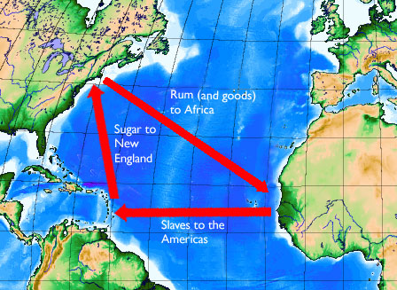
At a global scale, the molasses flood is a legacy of Boston’s part in the dark history of triangular slave trade across the Atlantic. The slave trade itself may have been outlawed long before, but it was central to the original flow of molasses from the Caribbean to New England, which would eventually lead to this tank and this disaster. (Side note: baked beans’ popularity thanks to the molasses—i.e., slave—trade is often cited as an origin of the “Beantown” nickname, so if you still needed a reason never to use that name, there’s one.)
A final, non-geographical thought: today with nobody alive who would remember it, we think of the molasses flood as a quirky, almost amusing story. To say nothing of its modern relevance —for example legal precedent or the parallel between 1919’s “did Italian anarchists do this?” and today’s “did terrorists do this?” reaction to disaster—if you stop to think or read (in Puleo’s book) about the victims’ suffering, man, it was a frighteningly awful thing to happen! Being crushed by a building and subsequently drowning in sticky, thickening molasses in the cold has got to be low on anyone’s list of preferred ways to die.
But it’s okay to move on. Enjoy a molasses cookie today and begin a century of happy molasses memories.